
Established as The Skamokawa Eagle in 1891
Established as The Skamokawa Eagle in 1891
Ian Sinks and Ramona Arechiga of Columbia Land Trust outlined their efforts to address the concerns of neighboring property owners over plans to breach the Grays River dike.
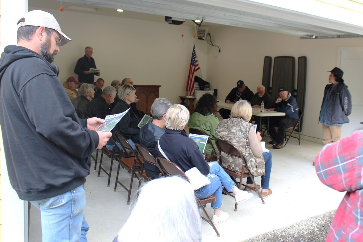
On Wednesday, May 29, the Wahkiakum County Commissioners held a special meeting on the Rosburg property of Rick and Kelli Ballif. The purpose of the meeting was to hear Columbia Land Trust's plans for breaching the Grays River dike to inundate bordering wetland and to hear the concerns of residents whose properties adjoin that wetland.
Ramona Arechiga and Ian Sinks spoke on behalf of the Columbia Land Trust (CLT) noting the project is intended to provide an area of calm, nutrient rich water for salmonid parr to gain strength and stamina before entering the Columbia River and subsequently the Pacific Ocean. Arechiga spoke at length of the efforts CLT is undertaking to address neighbors' concerns. For the past year, monitors have been in place to record the water levels in the area of the Alder Drive roadbed. Engineers hired by CLT are working on a design to address the concerns of neighboring property owners that will include mathematical modeling of various water level events.
Property owners Monte Givens and Rick Ballif informed the commissioners the major concern was over the potential for damage to Alder Drive, causing it to fail thus destroying the only access to the five residences of the families living at the end of the road. Left unchecked, the water from the river to the south combined with the surface water flow from the watershed to the north could damage and weaken the base of the raised road causing it to fail. CLT has proposed a setback levy designed to hold the river water back, noted Givens, but that, in turn, then becomes a dam for the water from the north. One or more tide gates would allow water to flow through the setback levy when the tidal river water is at its lowest levels. In effect, this causes the surface water draining from the north to mimic the ocean tides as it backs up during high tides and drains to lower levels during low tides thereby creating the same concern regarding the Alder Drive roadbed.
Denzil (Rocky) Rose owns and resides on property adjoining the wetland to the west. His concern is in regard to the potential impact the CLT project might have on his drilled well.
Judy Johnson, Grays River Flood Control District Commissioner and Vice-Chairperson noted at least 56 salmon restoration related projects have thus far been completed in Wahkiakum County and questioned the need for the inundation project proposed by CLT.
In excess of thirty people were in attendance at the meeting which had been scheduled at the request of the county's Real Property Rights Advisory Board (RPRAB). RPRAB initially became involved in the project following recognition that the inundation of wetlands has the effect of moving the river's shoreline further landward and can cause neighboring properties to become subject to use restrictions under the state mandated Shoreline Master Program. Oddly, this occurrence was recognized in the past by the state legislature in RCW 90.58.580 as an inadvertent hardship on neighboring property owners but appears to limit relief to only those property owners within an Urban Growth Area thus leaving out property owners suffering the same inadvertent hardship within rural areas such as Wahkiakum County.
During the onsite meeting, RPRAB noted the absence thus far of any mention by CLT of the effect the proposed inundation could have on the ability of the current wetland to sequester carbon dioxide, a greenhouse gas believed to cause global warming. Whether one views global warming as a fact or a myth, carbon dioxide reduction is the state's highest environmental priority as evidenced by the higher fuel prices Washington residents are required to pay as a result of the state's Cap and Trade program for reducing carbon dioxide emissions. Wetlands are well recognized as sequestration sites for carbon dioxide by their vegetation and saturated soil. Inundation could cause a die-off of the wetland vegetation thereby releasing the sequestered carbon as carbon dioxide or methane. RPRAB suggested a possible nexus lies in control of the level of water allowed to enter the wetland from the river which, on the one hand, would be insufficient to cause the loss of existing vegetation but, on the other hand, be sufficient to serve the needed respite for young salmonid species. A potential benefit from the lower water level on the river side of the setback levy would be a lowered level of surface water runoff on the north side of the levy and a lessened opportunity for damage to the Alder Drive road base. CLT indicated its analysis of the project would include a review of the ability of the site to continue to sequester carbon.
At the conclusion of the meeting, the commissioners expressed concern over the potential adverse effects articulated by the residents and a strong interest in staying informed as the CLT design of the project continues. Appreciation was expressed by all present for the commissioners' interest in learning about the project and related citizen concerns.


Reader Comments(0)