
Established as The Skamokawa Eagle in 1891
Established as The Skamokawa Eagle in 1891
Lorraine Heilman, an oceanographer for NOAA shows off the acoustic Doppler current profiler, which sends a beam out into the water every six minutes to measure current speed by way of sound.
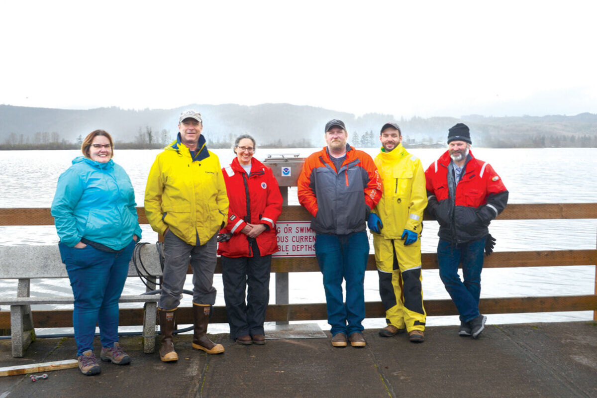
The team from NOAA from left to right: Engineer Shaena Rausch from Chesapeake, VA, Keith Brkich, Oceanographer and Project Lead Lorraine Heilman of Silver Spring, MD, Field Lead Drew Maczko, Pat McGovern, and Oceanographer Carl Kammerer of New Hampshire. Brkich, Maczko, and McGovern were members of the field team from the Seattle area.
A crane was needed to install NOAA equipment at the Cathlamet City Dock.
Last week, Lorraine Heilman, an oceanographer with the National Oceanic Atmospheric Administration, or NOAA, and her team were in Cathlamet to install equipment to do a tidal current survey.
"We're the tides and currents folks," she said. "We are trying to update the tidal current tables of the Columbia River."
Why? To keep waters safe for navigation.
The team was installing an acoustic Doppler current profiler, which measures the speed of water using sound, in the Cathlamet Channel.
"Everyone knows the Doppler effect," Heilman said. "It's the same thing. Very small particles of water reflect the sound back to our instrument. Depending on how fast they are moving past our instrument, the sound is frequency shifted, just as it is with the train."
They have another instrument set up in Astoria, and they will be monitoring data measured every six minutes, until next September.
Later this summer, they'll place another similar instrument on the other side of Puget Island to make measurements in the shipping channel.
The plan is to collect data for a year, which will be analyzed to come up with better estimates for tide tables.
"Especially with rivers that are so heavily dredged as the Columbia River," Heilman said, "when you change the shape of the channel, the currents change as well."
"The hard part about the Columbia is that the river flow is as much as the tidal changes," Heilman said. "Sometimes in the Columbia instead of a flood and an ebb, you end up with a big ebb and a little ebb.
"Often when we do these surveys to update current predictions, we do it for only a few months, but because the Columbia is so challenging, we have two stations that we are watching for the whole year."
NOAA tries to update the tables every decade, Heilman noted, but they haven't been in the Columbia River since 1980 for that purpose.
The are also measuring the height of water with four or five tide gauges up and down the river in Skamokawa, at Wauna, in Astoria, and Longview.
Heilman said that they data was also telling them about sea level rise trends.
"Some of our longest standing tide gauges that measure the height of the water have been in place for well over 100 years," she said. "The technology of the tide gauge has changed from a guy reading it once an hour off a stick and writing it down to pressure sensors, to acoustic sensors, to microwave sensors."
"We have continuous records, which I think is exceptionally cool," she added.
According to Heilman, tides can be seen in the river up to Bonneville. Salt can be found in the water around Cathlamet, but the river is mostly salty and brackish around Astoria and out towards the mouth.
"[The Columbia River] is fast, it's wide, it has a very huge amount of water flowing in and out," she said. "There is a lot of sand movement at the bottom and suspended solids. So one of the other things we are doing with this project is working with the United States Geological Survey.
"The USGS and the Army Corps are updating a sediment transport model for the Columbia River that helps predict where things shoal and where the channels stay open. That in turn helps the Army Corps with what they need to do with dredging."
"Oceanography is fascinating."
Anyone interested in seeing the data should send message to http://www.tidesandcurrents.gov.


Reader Comments(0)